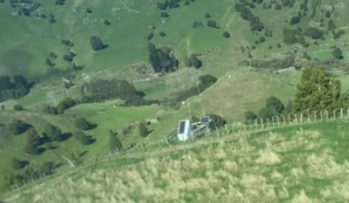
Near-miss reports from South Island pilots involving Halter towers have raised aviation safety concerns, especially for low-flying agricultural aircraft.
Halter replaces traditional fencing with GPS mapping and solar-powered collars to guide cows with sounds, vibrations, or mild pulses. The collars track health and sends data to the Halter app via transmission towers —no cell coverage needed.
While these towers don’t pose a risk to commercial aviation, they do to low-flying agricultural pilots. Without prior knowledge of tower locations, these obstacles can present serious risks during aerial operations.
Richard Smith from Aerowork Aerial Spreading (Ravensdown), who services Golden Bay, Kaikōura, and the West Coast, says that while he is aware of the concerns surrounding Halter transmission towers, he has not personally encountered any significant issues or impacts to date, but agrees that the risk needs highlighting.
Richard, who operates a fixed-wing aircraft, notes that the challenges appear to mainly affect helicopter operators, particularly those spraying dairy farms at very low levels. He also pointed out that Halter is not the only company using tower-based systems for cow monitoring, with several other technologies in the market operating in a similar way.
A spokesperson from Halter says the company is proactive in ensuring the safe installation and operation of its transmission towers on farms.
“We explicitly inform farmers of the importance of informing agricultural aviation operators of tower locations before they commence operations on their farm,” the spokesperson said.
They added that Halter works collaboratively alongside the New Zealand Agricultural Aviation Association (NZAAA) to promote safe operations for farmers and agricultural aerial operators.
Patrick Amberger from CTC Helicopters Tasman said he hasn’t encountered many Halter towers yet but recognises it could become more of an issue as the number of systems in the area increases.
“I can see how it could become a bigger problem. The towers are hard to see—they blend into the background and hillsides. Painting them a bright colour would help,” he said.
He also noted that having the towers appear on aviation GPS systems, such as Tabular, would be beneficial.
However, a Halter spokesperson confirmed they don’t publicly share the location or number of Halter farms as the information is “commercially sensitive.” Making it highly unlikely for the towers to be visible on GPS systems.
The towers stand 7 to 10 metres tall and are often placed on ridge tops for maximum coverage. While compliant with Civil Aviation Authority rules—which require notification only for structures over 60 metres—they sit within the typical flying range of agricultural helicopters (3 to 10 metres).
The Halter spokesperson noted their height is similar to common farm structures like power poles and sheds. Still, anything at that altitude—tree or tower—can be a hazard during low-level operations.
Simon Moar from Marlborough Helicopters acknowledges the issue in other regions but notes that with only a handful of dairy farms—mostly in the Rai Valley—it hasn’t been a problem locally. However, he did express concern.
“Farmers don’t always realise the towers pose a hazard because they don’t think we fly that low,” he explained. “A pilot might fly over the same land for years, then suddenly come around a hillside and find a tower they weren’t expecting.”
He emphasised that currently, the responsibility lies with both farmers and pilots.
“Farmers should inform pilots of any new structures or towers, regardless of their height, and pilots should always ask farmers about potential hazards.”
Simon also added that cows wearing collars can serve as a helpful indicator of farms that will have towers.
