Results of an independent survey on woody debris left along Nelson Tasman coastlines following the floods of June and July 2025, has provided more detail on exactly what the debris was. Over the next few weeks, Sara Hollyman will look at the report in depth, while talking to forestry experts. Today we share a broad overview of the report’s findings.
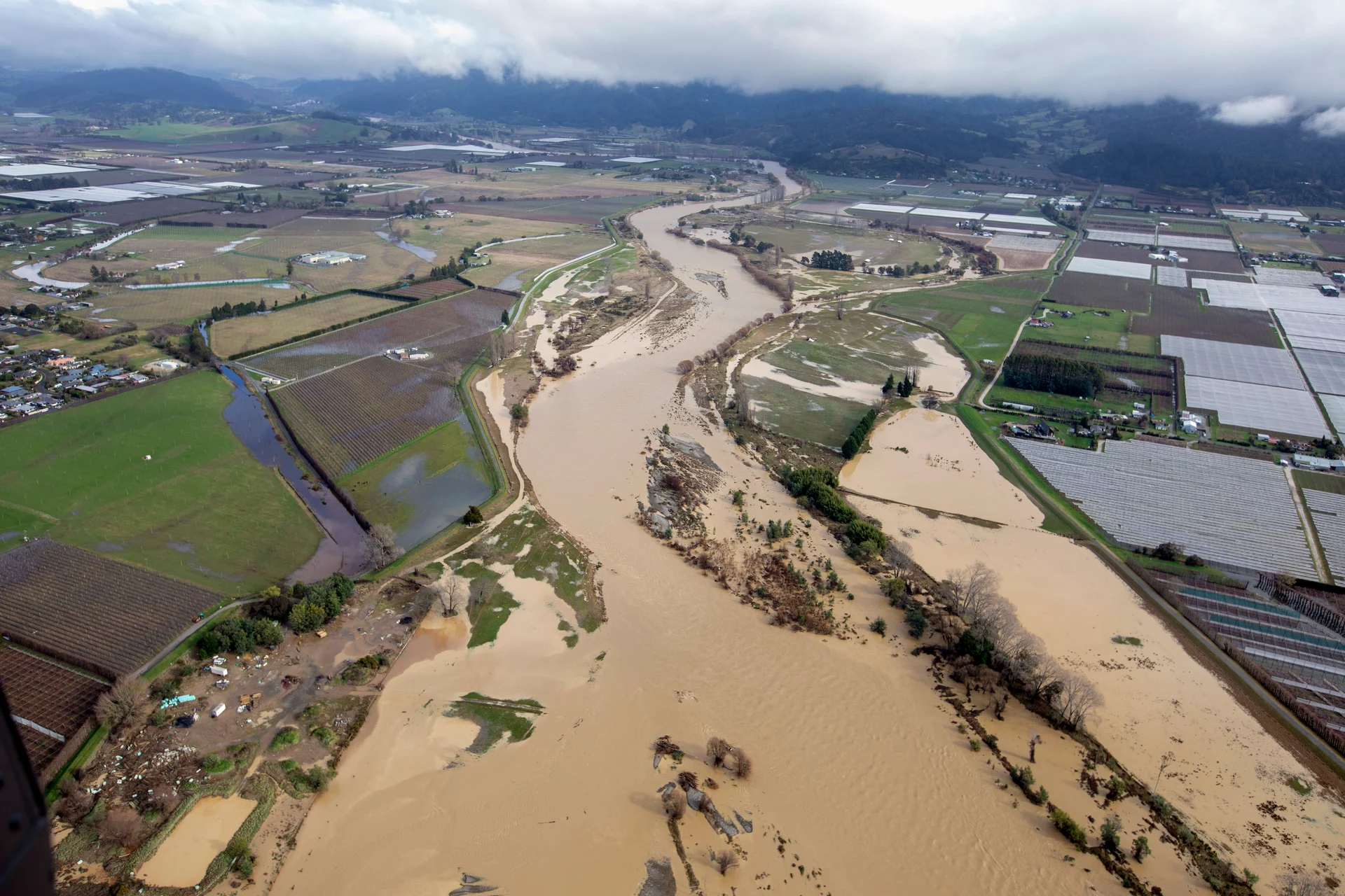
Severe storms that battered the Tasman region in mid-2025 left debris strewn along the coastline, but a new report suggests much less of it was forestry ‘slash’ than first thought.
An independent assessment of woody debris across Tasman Bay has found just 5 per cent of material could be clearly linked to forestry harvest residue.
Commissioned by the Forest Growers Levy Trust and Te Uru Rākau – New Zealand Forest Service, the study analysed debris deposited along about 18km of coastline between Mārahau and Tāhunanui after heavy rain, flooding and strong winds in June and July last year.
Researchers mapped about 30 hectares of affected coastline and carried out detailed sampling across 59 sites, from Kaiteriteri through to Tāhunanui.
Tasman Pine Environmental and Resources Manager Dan Montgomery, who was on the ground for part of the time as an industry support, says, while the survey team was on the ground as quickly as possible, a lot of debris had already been cleared.
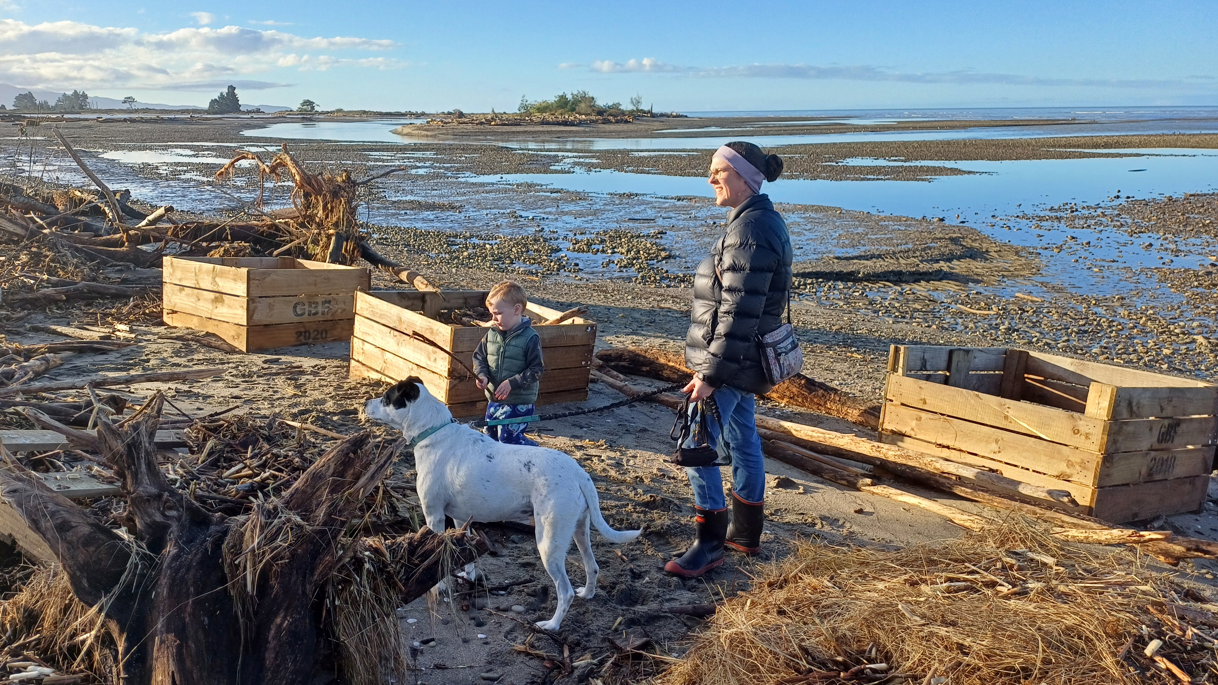
“The horticultural guys had already picked up hundreds of apple crates, fences all disappeared, we were almost late to the party, and we were pretty quick.”
The findings show most debris was made up of a mix of sources, much of it heavily weathered and difficult to identify.
Eleven per cent of the total debris volume was linked to plantation forestry, including the 5 per cent classified as harvest ‘slash’ – wood that showed identifications of having been harvested such as waratah marks – and a further 6 per cent likely to be plantation-origin timber.
In contrast, 21 per cent was identified as non-plantation pine or conifer.
Dan uses an example of a stand of radiata pine at the mouth of the Riwaka River as what could be determined as non-plantation trees.
“They are big, gnarly pine trees, and [some had] fallen into the water, and probably washed up on beaches, but it’s not forestry.”
Eleven per cent was identified as native timber. Other material included poplar and willow, eucalyptus, and manufactured wood such as fence posts, firewood and orchard bins.
A significant portion, about 40 per cent, could not be definitively classified due to extensive weathering, suggesting it may have been moving through waterways long before the 2025 storm events.
The report notes most debris pieces were relatively small, with 73 per cent measuring three metres or less and only 1 per cent longer than 12 metres. Overall volumes were also lower than seen in similar events elsewhere in New Zealand, including Cyclone Gabrielle in Hawke’s Bay.
Rather than being concentrated in large piles, debris was often scattered, with only localised build-ups.
The study also highlights a range of possible sources beyond forestry, including eroding riverbanks, coastal trees and infrastructure damaged during flooding. Apple bins and sections of boardwalk were among items found during field surveys.
In some areas, particularly near rivers such as the Motueka, erosion appears to have toppled trees into waterways, contributing to the debris carried to the coast.
Researchers say the weathering of much of the material suggests it may have been deposited and re-mobilised multiple times before reaching the beaches.
The report concludes it is inaccurate to describe the majority of debris from the storms as ‘slash’, noting that the material reflects a mix of land uses and natural sources across the region.
It also points to the need for better baseline monitoring of woody debris, so future storm impacts can be more clearly understood.